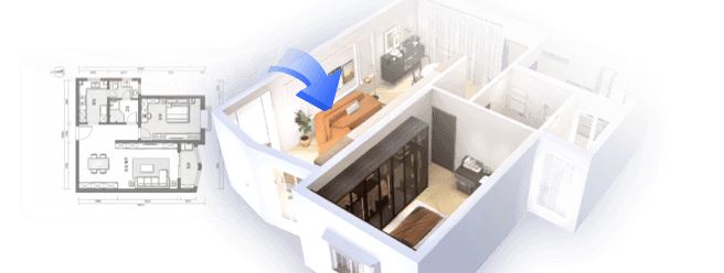
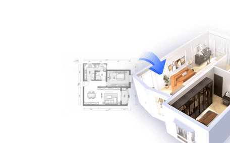
Are you excited to discover how to integrate a 3D model into Google Earth? This technique can significantly enhance your projects by enabling you to visualize them against a real-world backdrop. In this tutorial, I will guide you through the procedure for creating and importing a 3D model into Google Earth, using tools like Homestyler.
Grasping 3D Models in Google Earth
Before embarking on the steps, it's important to grasp what constitutes a 3D model. Essentially, a 3D model is a digital illustration of an object visible in three dimensions. Google Earth provides users with the capability to import and visualize these models within its virtual globe. Being able to view a model can be immensely beneficial for architects, urban planners, and designers during both planning and presentations.
Creating Your 3D Model
The initial step involves developing or sourcing a 3D model. Software options like SketchUp, Blender, or even Homestyler can be ideal for crafting your designs. Ensure your model is saved in a compatible format, either .KMZ or .KML, which are specifically tailored for Google Earth use.
Once your model is perfected, export it to .KMZ format, which is typically achievable through the 'File > Export' feature in your design software. It’s crucial to export correctly to maintain the textures and details of your model when uploading it to Google Earth.
With your KMZ file set, the next step is to import it into Google Earth. Open Google Earth and select 'File > Import'. Navigate to your saved KMZ file and select it for import. Your 3D model should now be visible in the Google Earth interface, allowing you to manipulate, rotate, and view it from multiple perspectives.
Enhancing Your Visual Experience with Layers
To further accentuate your model within Google Earth, consider using layers. Layers enable you to amalgamate various components, such as geographic data, placemarks, and paths, granting a holistic view of your project. You have the ability to toggle these layers on or off to facilitate your presentations.
After importing your model and ensuring it is properly situated, you may want to share it. Utilize the sharing feature in Google Earth to generate a link or email it directly to others. This collaborative capacity can be instrumental in collecting feedback on your designs.
Common Questions
Q: What kinds of 3D model formats can be imported into Google Earth? A: Google Earth accepts .KMZ and .KML formats for 3D model imports.
Q: Is it possible to modify my 3D model after it has been uploaded to Google Earth? A: You cannot edit the model within Google Earth; modifications must be made in your design software followed by re-importing the updated model.
Q: Is there a maximum size limit for 3D models used in Google Earth? A: Indeed, it's advisable to keep your models below 5MB to ensure optimal loading and rendering performance.


Looking to design your dream home? Homestyler offers an easy-to-use online design tool that brings your ideas to life with stunning 3D renderings. Explore numerous design projects and enhance your skills with helpful DIY video tutorials. It's perfect for all design enthusiasts, whether you're a beginner or a pro!
Diseño ahora GRATIS